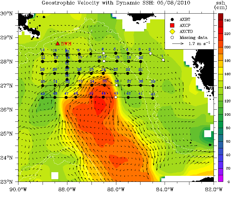
The University of Miami Rosenstiel School of Marine and Atmospheric Sciences was tasked to provide an exploratory, baseline oceanic temperature survey to map oceanic structure between the Loop Current (LC), which has a surface current speed of 3 knots, and its surrounding eddy field including both the clockwise and counterclockwise rotating eddies. Such measurements provide the important data to correlate to surface images and data from satellite measurements as well as provide initial subsurface structural conditions for predictive ocean models.
The Upper Ocean Dynamics Laboratory deployed nearly 600 Airborne Expendable Bathythermographs (AXBT), Airborne Expendable Conductivity/Temperature/Depth (AXCTD), and Airborne Expendable Current Profilers (AXCP) from a NOAA P3-Orion aircraft for three months following the rig explosion. The different maps below correspond to each flight. Flight tracks and drop points overlay the geostrophic currents for that day
Loop Current Data